Which Smoky Mountains waterfalls should you visit? How will you choose? There are dozens of waterfalls in Great Smoky Mountains National Park, but you probably won’t be visiting all of them (at least not on one trip).
So, based on our experience, let us help you narrow the list a bit. Following are 17 Smoky Mountains waterfalls we love – we believe you will love them, too. They are grouped according to their location in the park.
Published November 11, 2023…Updated January 11, 2025


Waterfalls in the Cades Cove-Townsend Area
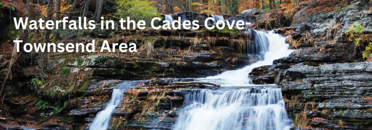
Cades Cove and Townsend are on the northwest side of Great Smoky Mountains National Park. Most visitors to Great Smoky Mountains National Park are familiar with, or at least aware of Cades Cove. But not everyone is aware that one of the best falls in the park is here.
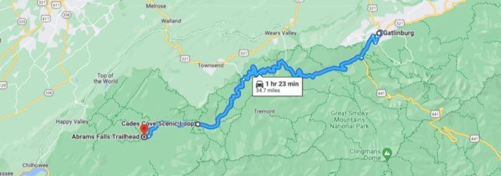
(Click on the map for an enlarged image of the route to Abrams Falls.)
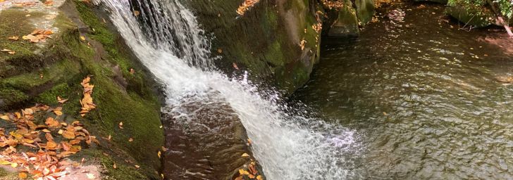
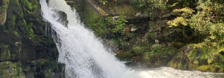
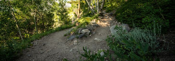
1. Abrams Falls
Abrams Falls is one of the best-known of the Smoky Mountains waterfalls. It is also one of the most visited.
Abrams Falls is halfway through the Cades Cove Scenic Loop Drive. Simply drive west from Gatlinburg on Little River Gorge Rd, which will become Laurel Creek Rd at the “triangle”, (the turn to Townsend). Continue straight until you reach the entrance to Cades Cove.
Begin the scenic drive through Cades Cove, and you will arrive at the turn to the Abrams Falls parking lot in 5.6 miles, almost exactly halfway through the scenic loop drive. The entire trip from Gatlinburg is 34 miles and should take between 1 hour and 1.5 hours.
Quick Facts
- Distance – The hike to the falls is 5.0 miles roundtrip.
- Duration – 3-4 hours, depending on how often you stop for photos, and how long you stay at the falls
- Difficulty – AllTrails ranks this hike as “Moderate”. There is not much elevation gain.
- Dogs – Not Allowed
- Parking – Yes, there is a large parking lot here
- Restrooms – Yes, in the parking area
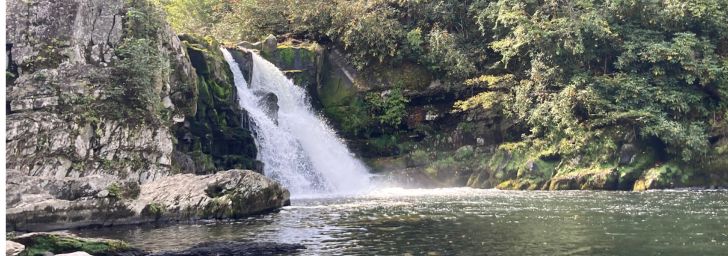
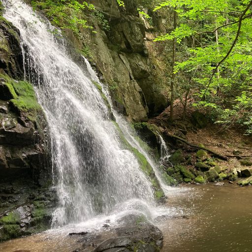
Abrams Falls falls 25′ into a very large pool. It is surrounded by large boulders, perfect for climbing on. You can even climb out to the edge of the falls. This is a great spot for a picnic lunch, or just to sit down and enjoy the view.
Waterfalls in the Tremont Road Area
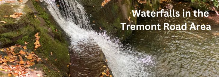
Tremont Road is our favorite area in the park. The road itself is home to some beautiful scenery, as it follows the Middle Prong Fork Creek. But the real treasure is the three waterfalls you can experience here.
(Click on the map for an enlarged image of the route to Tremont area waterfalls.)
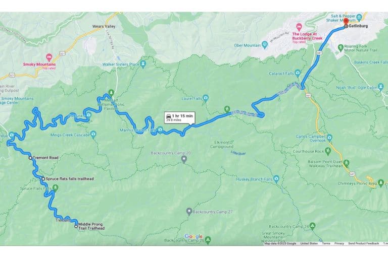
2. Spruce Flats Falls
The trailhead to Spruce Flats Falls begins in the parking lot of the Tremont Institute on Tremont Road. Drive 23 miles heading west from Gatlinburg, TN on the Little River Gorge Road. Just past the turnoff to Townsend (don’t turn here – continue straight), you will come to Tremont Road on your left. Turn left onto Tremont Road.
Drive down Tremont Road for just over one mile, and you will see Great Smoky Mountains Institute at Tremont on your left. Turn into the Institute and park in the parking lot behind the building. The trailhead begins in the back right corner as you enter the parking lot.
Quick Facts
- Distance – The hike to the falls is 1.6 miles roundtrip on the Buckeye Trail and the Lumber Ridge Trail.
- Duration – 2-3 hours, depending on how often you stop for photos, and how long you stay at the falls
- Difficulty – AllTrails ranks this hike as “Moderate”. The hike is short but is uphill almost all the way to the falls.
- Dogs – Not Allowed
- Parking – Yes, there is a large parking lot at Tremont Institute
- Restrooms – Yes, in the Tremont Institute Gift Shop
Hike up the drive to the Tremont dorms and cut off to your left behind them to pick up the trail. Just a few steps later, you will come to a fork. Be sure to go right here. Going left will put you on the Lumber Ridge Loop Trail, which is significantly longer.
T
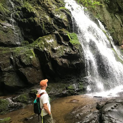
As you can see from the earlier photo, it is possible to stand right next to Spruce Flats Falls. (I suppose you could even stand under it if you wanted to – though I wouldn’t recommend it,,,)
After enjoying the falls, be sure to hike downstream a bit so you can view the waterfall “straight on.” It’s a beautiful sight!
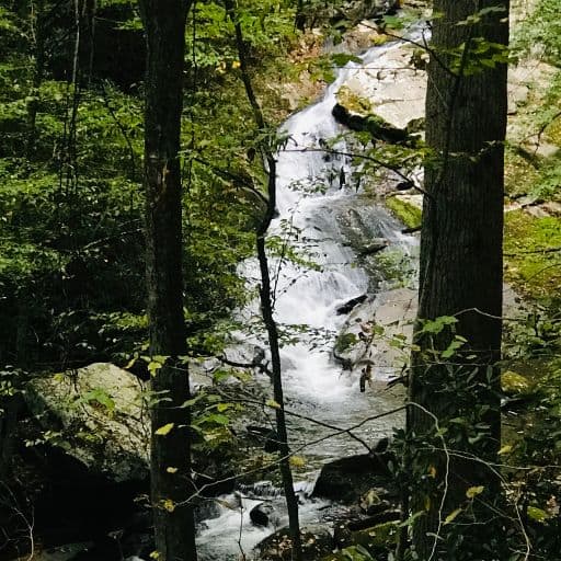
3. Lynn Camp Prong Cascades
If you scroll back up to the map of the Tremont area, you’ll see that Tremont Road dead ends at a parking area at the trailhead of the Middle Prong Trail. This is where the hike to the Lynn Camp Prong Cascades begins.
Quick Facts
- Distance – The hike to the falls is 1.4 miles roundtrip.
- Duration – 1.5 – 2 hours
- Difficulty – AllTrails ranks this hike as “Moderate”. The trail is wide and well-maintained. It has a modest elevation gain. Let’s call it “Easy to Moderate”.
- Dogs – Not Allowed
- Parking – Yes, there is a large parking lot at the trailhead
- Restrooms – Yes, in the Tremont Institute Gift Shop back up the road
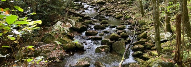
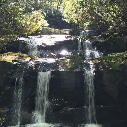
This is one of the prettiest of the Smoky Mountains waterfall hikes in the entire park. It follows the Lynn Camp Prong, which is made up of cascade after cascade after cascade. You are just steps away from dozens of wonderful photo opps.
The actual cascade flows down a long, narrow rock shoot, with a great deal of force. It’s quite impressive. You will know you’re there when you arrive at the bench overlooking the cascade. A bit farther up the trail are two more benches.
4. Indian Flats Falls
As long as you’re already at Lynn Camp Cascade, you might as well continue on to Indian Flats Falls – it’s a bit over 3 miles farther up the trail. And it’s worth every step!
Quick Facts
- Distance – 7.8 miles roundtrip
- Duration – The hike took us 4 hours roundtrip, but we did a LOT of exploring and bushwhacking along the way!
- Difficulty – AllTrails ranks this hike as “Moderate”. The trail is wide and well-maintained, with an elevation gain of about 300’/mile over the first 3.9 miles.
- Dogs – Not Allowed
- Parking – Yes, there is a large parking lot at the Middle Prong trailhead
- Restrooms – Yes, in the Tremont Institute Gift Shop back up the road
Finding Indian Flats Falls

There’s no sign pointing to the falls, so it’s easy to miss.
After passing Lynn Camp Prong Cascades,continue on for approximately 2 miles, and you will come to a trail sign at the intersection of Panther Trail. Stay on Middle Prong Trail, and continue straight for a bit over 1 mile, where you will come to two sets of switchbacks.
“What’s a Switchback?”
(If you’re new to hiking, a “switchback” is “a trail that cuts sharply from one direction to the other while going up a steep hill or mountainside.” Switchbacks make climbing an incline easier.)
At the end of the first switchback (you’ve completed two inclines), there will be a side trail, but there is no sign, and it is not easy to spot. We missed it the first time!
“I May Be Lost…”

If you get to the trail sign where Greenbriar Trail and Lynn Camp Prong Trail intersect (like we did), you’ve gone too far. Walk back down the previous switchback. (You will walk down two inclines.). At the second turn, there will be an open space.
Standing in the open space at the bottom of the second incline, you will see a rock face, 5′-7′ high, with a large rhododendron shrub to the right and in front of it. A kind soul has placed a cairn here on top of an old log.

Walk towards the rock face, and behind the rhododendron is a small, narrow trail that leads off to your right. WooHoo! You’ve found it! Follow this small trail. Be careful, because it’s slippery and rooty. After a short five-minute walk, you will emerge at the base of Indian Flats Falls!
“I Finally Found It!”
Indian Flats Falls actually has four levels of falls, but you’ll have to do some bushwhacking through the woods to see them all. Just follow the path of the water, making your way through the woods, and be able to see them all!
This may be our favorite of the Smoky Mountains waterfalls. It’s a longer hike, but if we can make it (we’re both in our 60’s), you probably can, too!
Waterfalls in the Central Section of Great Smoky Mountains National Park
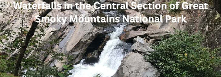
There are several great waterfalls located centrally in the park. These have the advantage of being closer to Gatlinburg and Pigeon Forge, the two towns where most folks stay when they visit the Smoky Mountains. Less drive time – WooHoo!
(Click anywhere on the map to enlarge the image.)

5. Laurel Falls
Laurel Falls is one of the most popular waterfalls in the Smoky Mountains for several reasons. First, it’s an easy location to get to. Second, it’s a short, easy hike. Third, there’s a good chance you’ll see a bear here. We did!
But please note, it’s VERY crowded. There are a couple of parking lots at the trailhead, and a couple more both up and down the road, but some folks park almost 1 mile away from the trailhead! Our advice, get there early!
Quick Facts
- Distance – The hike to the falls is 2.5 miles roundtrip.
- Duration – 1.5 – 2 hours, depending on how long you stay at the falls
- Difficulty – AllTrails ranks this hike as “Easy”. The trail is paved, though much of the asphalt has washed away. There is an elevation gain of 404′.
- Dogs – Not Allowed
- Parking – Yes, there is a large parking lot at the trailhead and additional lots both up and down the road. But be aware that these fill up quickly
- Restrooms – No

When you arrive at the falls, the first thing you’ll probably notice is the bridge. The bridge crosses over the small pool at the base of the falls. The second thing you’ll probably notice is the people – lots of people.
There is a small area on the far side of the bridge where people stand, sit, take photos, take a break, etc. It’s a great place to meet people because there are so many of them there!
It is also a potentially dangerous spot, especially for small children, because the left side of the bridge has a sheer, steep drop. Hold on to your kids!

The third thing you will probably notice is Laurel Falls itself. It’s not very large (in terms of volume), but you are standing just a few feet away from it, so the experience is very nice!
Pro Tip
Laurel Falls closed on January 6, 2025, to undergo 18 months of major renovations, including more parking, trail maintenance, and a new observation deck.
6. The Sinks
The Sinks are an area where the Little River sinks 12′, creating a small, powerful waterfall. The falls are beneath a bridge, right off the road – no hiking involved. There is a large viewing platform area here, both for viewing and for safety.
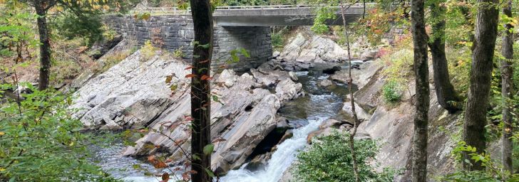
The Sinks area is between Gatlinburg and the turnoff to Townsend (Hwy 73), on Little River Road. It is 12 miles west of the Sugarlands Visitor Center. Keep your eyes open – it is easy to miss!
Quick Facts
- Distance – No hiking to The Sinks. Just get out of your car, and there it is!
- Duration – Spend as much or as little time here as you like
- Difficulty – Easy
- Dogs – Not Allowed
- Parking – Yes, there is a parking lot here
- Restrooms – No
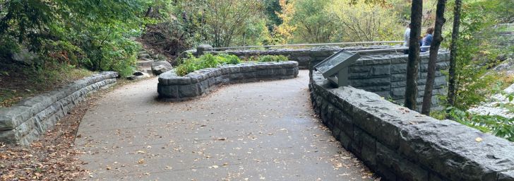
After parking your vehicle, you will walk down a sidewalk to the viewing platform. This will afford you wonderful views of The Sinks, as well as keep you and your children safe. DO NOT climb down to the falls – numerous people have been injured here!
Though the falls here are only 12′ high, they are impressive for their power and the volume of water they move. This is one of those places you can “feel” as well as see.
7. Meigs Creek Cascade
We began looking for this hike because we could see the waterfall from the road. When we finally found it we discovered it was not what we had seen from the road, but an entirely different waterfall! (More on this later.)
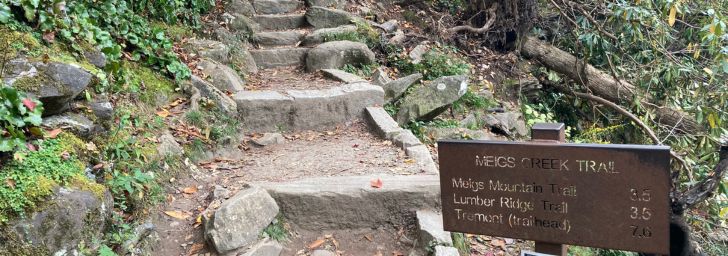
The trailhead to Meigs Creek Cascade begins at the far end of The Sinks. Just walk past the viewing platform, and you’ll see the steps and trail sign.
Quick Facts
- Distance – The hike to the falls is 3.6 miles roundtrip.
- Duration – 2.5 – 3 hours
- Difficulty – AllTrails ranks this hike as “Moderate”.
- Dogs – Not Allowed
- Parking – Yes, there is a large parking lot at The Sinks
- Restrooms – No
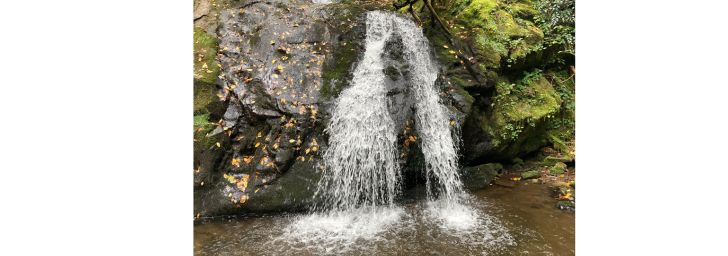
Though we were expecting something larger, we were not disappointed in Meigs Creek Cascade. We had the trail mostly to ourselves. The trail itself was still showing off wildflowers, even in October.
The falls drop 25′ into a pool surrounded by trees and other vegetation. It’s a peaceful, secluded spot.
8. Meigs Falls
Who knew there is a “Meigs Falls” and an “Meigs Creek Cascade”? We didn’t. The two are both fed by Meigs Creek, but they are miles apart. Meigs Falls can be seen from a pullout on Little River Road, about 1 mile west of The Sinks.
Quick Facts
- Distance – This is one of the few Smoky Mountains waterfalls that has no hiking trail to it. You can view it from the pullout on Little River Road, or, if you’re feeling adventurous, you can park your car, scramble down to the Little River, cross it, and bushwhack your way to the base of the falls. Warning: This is more than a little risky, and you ARE going to get wet.
- Duration – Spend as much or as little time here as you like
- Difficulty – None
- Dogs – Yes, but make sure they are leashed. This is a busy road!
- Parking – Yes, there is a small pullout here – enough for a handful of vehicles
- Restrooms – No
Meigs Falls is best viewed in late fall or winter when the leaves have fallen off the trees. Look for the pullout that has a long, short stone wall attached to it.
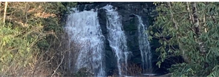
Waterfalls in the Gatlinburg Area
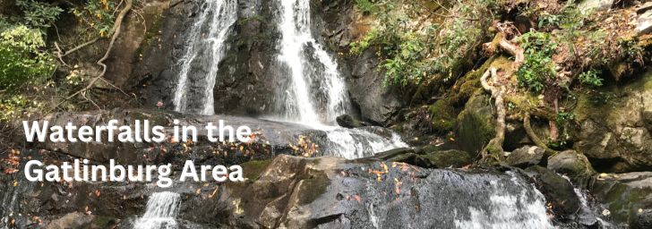
If you’re staying in Gatlinburg and you want to see waterfalls, you won’t have to drive far. There are numerous waterfalls located in the town. Most of them can be reached via the Roaring Fork Motor Nature Drive.
(Click anywhere on the map for an enlarged image of the Roaring Fork Motor Nature Trail.)
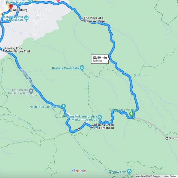
9. Rainbow Falls
Rainbow Falls is the first waterfall you will come to on the Roaring Fork Motor Nature Trail. It tends to be crowded, especially in the summer.
Quick Facts
- Distance – 5.5 miles roundtrip
- Duration – 3.5 – 4 hours
- Difficulty – AllTrails rates this hike as “Moderate”, and we would agree. The first 2.6 miles are all uphill to the falls. Of course, when you turn around and walk back, it’s all downhill. Yes!
- Dogs – Nope. Sorry
- Parking – There are two parking lots for Rainbow Falls.
- Restrooms – Yes, in the first parking area

You can tell from the photo above that this is a tall waterfall. It has a 75′ drop. However, the days before we hiked to the falls had had very little rain, so the water flow volume was very small. Bummer.
Still, the scenery was beautiful, and there was an abundance of large boulders at the base of the falls, perfect for climbing and scrambling.
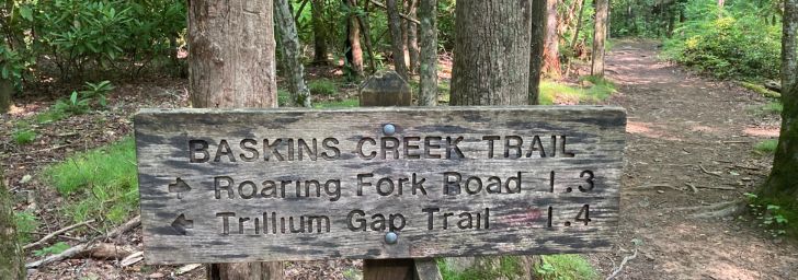
10. Baskins Creek Falls
The next waterfall on Roaring Fork Motor Nature Trail is Baskins Creek Falls. This is one of the few waterfalls in the Smoky Mountains that you hike down to, instead of up to. (Of course, that means you’re hiking uphill almost all the way back…)
We enjoyed our hike to Baskins Creek Falls, mostly because we had it all to ourselves. This is a quiet, peaceful walk to an interesting little waterfall. It has two levels, dropping from the top down to a ledge before spilling out to a small pool at the base of the falls.
Quick Facts
- Distance – 3.2 miles roundtrip
- Duration – 3 hours
- Difficulty – Moderate. The trail is rocky and rooty, and there is a good bit of climbing to do.
- Dogs – Nope. Sorry
- Parking – Here’s a tip…park in the second Rainbow Falls parking lot if there is a spot available. Then walk out of the lot, turn right, walk a few more feet, turn right again, and walk the 0.2 miles up the road to the trailhead. There is ONE pullout parking spot at the trailhead, and if it’s taken, you will have to park somewhere farther up the road, or make the entire loop again, because the road is one-way.
- Restrooms – The nearest restroom is in the first Rainbow Falls parking lot.


The trail to Baskins Creek Falls is not hard, but neither is it easy. It has its share of rocks and roots. There are sections of the trail that are muddy and slippery – we both fell…TWICE!
On the other hand, it was quiet, there was an abundance of wildflowers on the trail, the two-tiered waterfall had a 35′ drop, and I followed a black bear down the path for a bit.
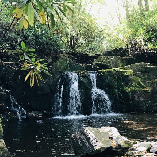
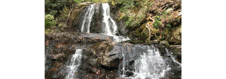
11. Grotto Falls
Next up on the Roaring Fork Motor Nature Trail is Grotto Falls. This waterfall hike was a lot of fun! We highly recommend it – it’s a short, easy hike, and the falls are a delight – especially if you have kids!
Quick Facts
- Distance – 2.6 miles roundtrip
- Duration – 2 hours
- Difficulty – Moderate. The trail to the falls is 1.3 miles of climbing.
- Dogs – No dogs allowed
- Parking – There is a parking lot at the trailhead
- Restrooms – Yes
Grotto Falls is not large. It only has a 25′ drop, and the volume of water is not very impressive. What IS impressive, and fun, is that you can walk behind the falls to the other side! People (including me), were lining up to have their photos taken behind the falls.
There is also a small, shallow pool at the base of the falls, perfect for small children to wade and play in. A lot of kids there were having a blast here.
And…when we got back to the parking lot, we met a couple of gals from Ireland. While visiting with them, a mother bear and her three cubs emerged from the woods a few feet away from us. It was all just marvelous!


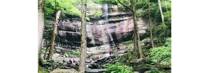
12. The Place of 1,000 Drips
The Place of 1,000 Drips is appropriately named: it’s a place…and it drips…a lot! This is the fourth waterfall you will come to on the Roaring Fork Motor Nature Trail. It is right on the side of the road – you don’t even have to leave your vehicle. But you might want to.
This is a great spot to do a little climbing and take some photos. But be careful – it’s right on the very busy road.

Quick Facts
- Distance – None. You just park your car and there it is!
- Duration – Take as long as you like
- Difficulty – Easy
- Dogs – No dogs allowed
- Parking – There is no parking lot here – just a pullout big enough for 2-3 vehicles
- Restrooms – No

The Place of 1,000 Drips is formed by Cliff Branch spilling over the edge at the top and tumbling down 85′. On the way down, the water divides into multiple routes, making for a stunning display. In some places, individual streams drop 10′-20′.
The effect is like that of prism. You will see light and different colors depending on where you stand. Just make sure you don’t stand in the road!
Waterfalls in the Bryson City/Cherokee Area
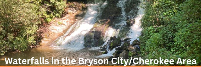
The towns of Bryson City and Cherokee are located on the south-central border of Great Smoky Mountains National Park. In fact, depending on which direction you are traveling from, you might enter the park through Cherokee. Both are nice towns, with several interesting things to explore there, including some fun waterfalls!
(Click anywhere on the map to enlarge the image.)
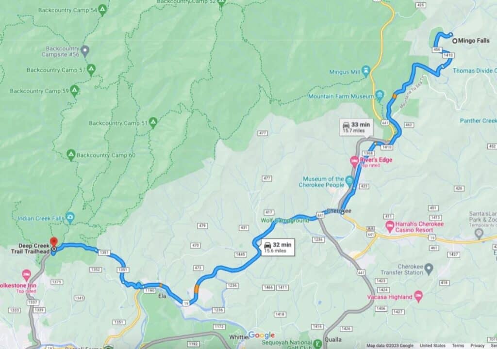
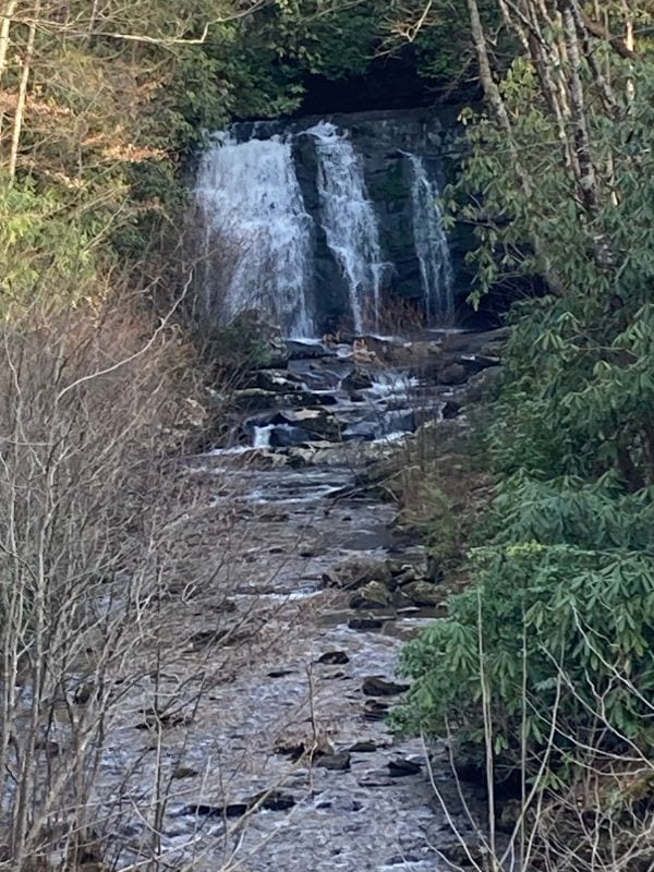
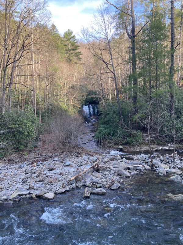
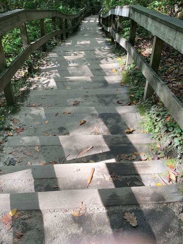
13. Mingo Falls
If you get in your vehicle, switch on your GPS, type in “Mingo Falls”, and follow its directions, you will arrive at this large sign…
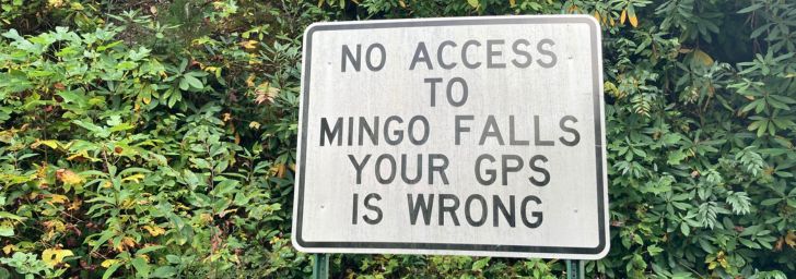
This sign has been here for years…and it’s correct! Your GPS is wrong! But do not fear – just go back one block to the main road, turn right, travel another 1.7 miles, and the entrance to the falls will be on your right.
Quick Facts
- Distance – 0.4 miles
- Duration – 30 minutes
- Difficulty – Mingo Falls is rated as “Moderate”. It’s very short but includes 160 stairsteps. Feel the burn!
- Dogs – No dogs allowed
- Parking – Yes, there are a couple of parking areas.
- Restrooms – There are two porta-potties in the parking lot
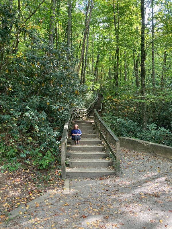
Mingo Falls has an impressive 180′ drop, making it one of the highest Smoky Mountains waterfalls, and while it is only 8′ wide at the top, it widens to 40′ at its base. The water splashes over hundreds of small shelves on its way to the bottom, creating a beautiful scene.
There is a small bridge at the top of the trail that makes for a perfect viewing platform. If you are a bit more adventurous, you can scramble over the rocks and boulders for a much closer look.
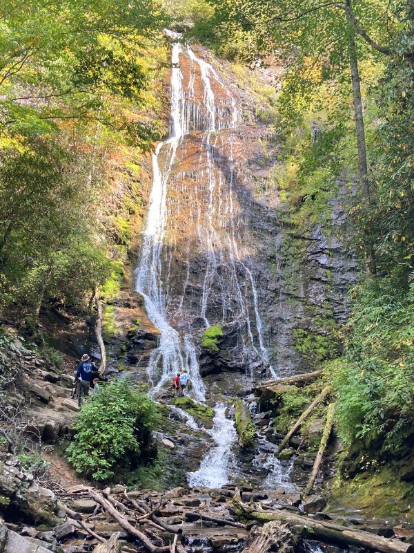
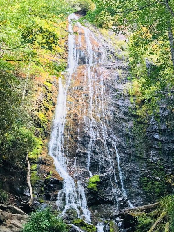
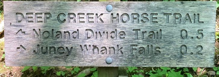
14. Juney Whank Falls
Juney Whank Falls is the first of three waterfalls in the Deep Creek/Bryson City area that are all connected by the same trail – Deep Creek Trail. The trail is located on West Deep Creek Rd, Bryson City, NC.
This is a fun area. There is a campground, concessions, innertubing on the creek, park rangers setting up exhibits, kids playing in the creek, etc. It’s also a crowded area, especially in the summer!
Quick Facts
- Distance – 0.6 miles loop
- Duration – 20-30 minutes
- Difficulty – Easy to Moderate. The first 0.3 miles is a fairly steep climb, while the second 0.3 is all downhill.
- Dogs – No dogs allowed
- Parking – Yes, there is a large parking area, which tends to fill up as it gets later in the day
- Restrooms – Yes, located in the campground
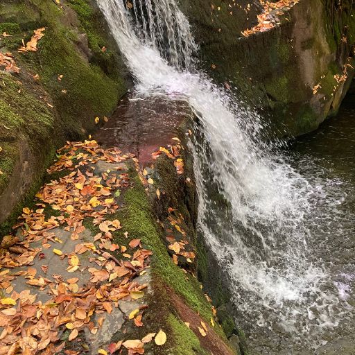
Juney Whank Falls is a cute little waterfall that you can get very close to. There is a footbridge that crosses over it, just 2′-3′ above it. The falls are much larger than they appear, with an 80′ drop that runs for 125′. Great spot for photos!
Juney Whank Falls most probably gets its name from Junaluska Whank, who lived in this area at one time and is supposedly buried nearby.
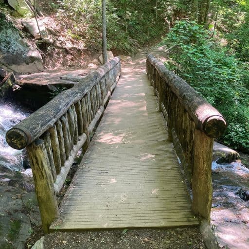
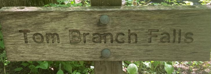
15. Tom Branch Falls
The Juney Whank Falls trail will intersect with the Deep Creek Trail – when it does, turn left and head for Tom Branch Falls. This is a gorgeous walk that follows alongside Deep Creek.
Quick Facts
- Distance – 0.5 miles roundtrip
- Duration – 20-30 minutes
- Difficulty – Easy
- Dogs – No dogs allowed
- Parking – Yes, there is a large parking area, which tends to fill up as it gets later in the day
- Restrooms – Yes, located in the campground
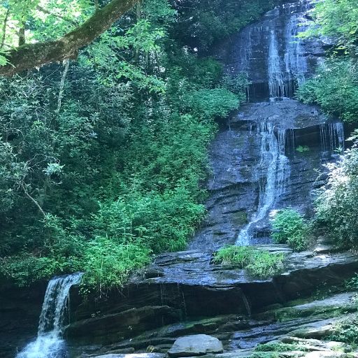

Tom Branch Falls is a popular spot. The water is shallow here, so children love it. There are benches here to enjoy the beautiful view. Park rangers set up educational displays here. On our last visit here a ranger was teaching kids (and adults) how to “nature journal”.
The falls are impressive, with three levels of water cascading over an 80′ drop. They were probably named for Tom Wiggins, a Civil War veteran who lived in the area in the mid-1800s.
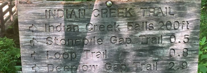
16. Indian CreekFalls
Not to be confused with Indian Flats Falls, Indian Creek Falls is the third waterfall on the Deep Creek trail. Simply continue past Tom Branch Falls until the trail divides. Take the right fork onto Indian Creek Trail – the falls are about 100 yards ahead.
Quick Facts
- Distance – 1.6 miles roundtrip
- Duration – 1-2 hours, depending on how often you stop
- Difficulty – Easy
- Dogs – No dogs allowed
- Parking – Yes, there is a large parking area, which tends to fill up as it gets later in the day
- Restrooms – Yes, located in the campground
Indian Creek Falls drops 25′ over a 45′ run. There is a large pool at the base. It’s a pretty setting, surrounded by wildflowers, especially rhododendrons. Look for the small side trail that leads down the base of the falls.
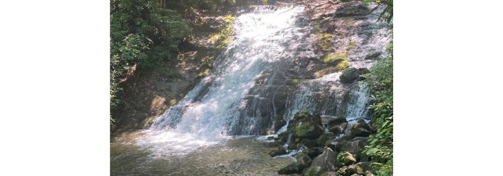
Waterfalls in the Maggie Valley Area
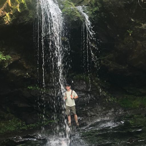
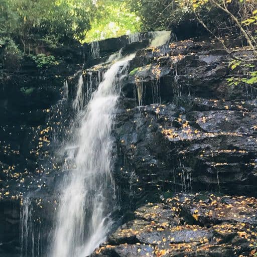
17. Soco Falls
We’ve saved one of the best for last! Soco Falls is in Maggie Valley, east of Cherokee. Though it is not technically in Great Smoky Mountains National Park, it is well worth the drive.
(Click anywhere on the map to enlarge the image.)
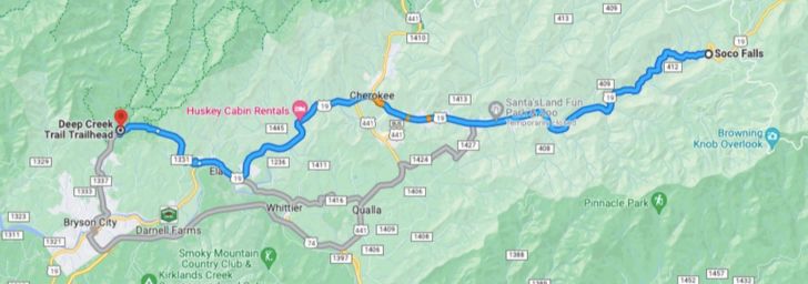
From Cherokee, drive east on Highway 19 for 11 miles. Keep your eye on your odometer, because there is no sign for Soco Falls. Look for the pullout parking area right on the highway. The trailhead is at the end of the parking area.
Quick Facts
- Distance – 0.2 miles roundtrip
- Duration – 15 minutes, depending on whether you climb down to the base of the falls
- Difficulty – Easy to the viewing platform; more difficult if you climb down to the base of the falls
- Dogs – No dogs allowed
- Parking – Yes
- Restrooms – No
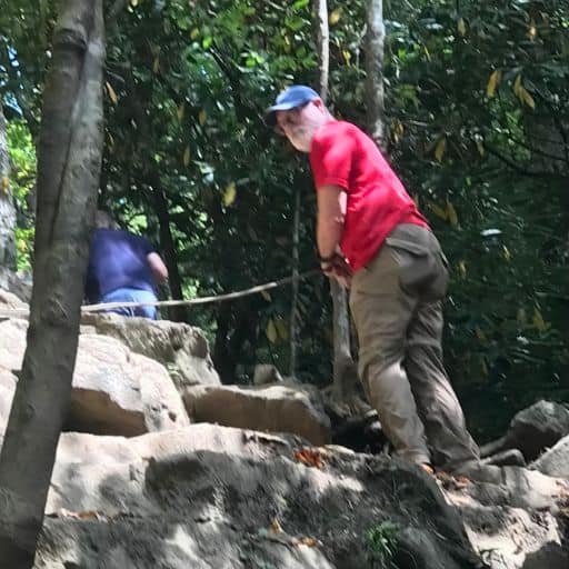
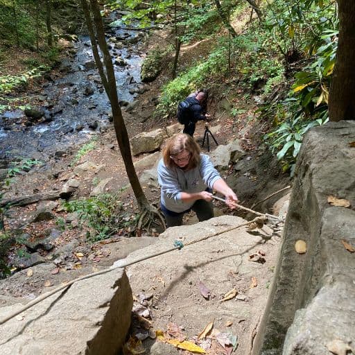
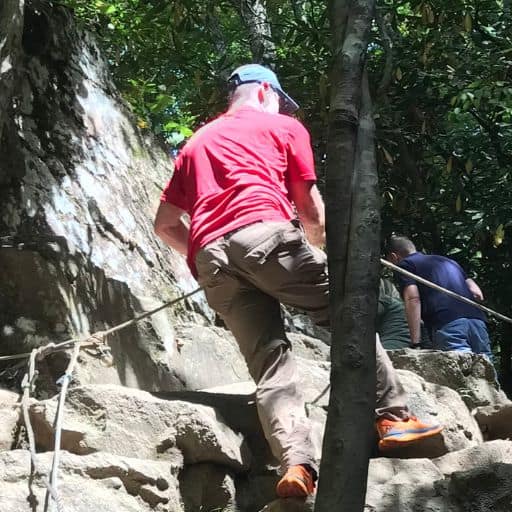
There are two ways to experience Soco Falls. (You should do both, if possible.) You can view it from the observation deck, which is just a short walk down the trail. This will give you a partial view of the falls, plus the deck is surrounded by beautiful wildflowers.
Or you can climb down 30ish feet to the base of the falls with the aid of a climbing rope, which is securely fastened to a couple of trees. The experience is like a combination of rock scrambling and rappelling. If you are physically able, this is a LOT of fun…and a little muddy.
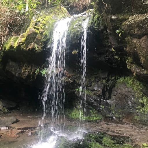
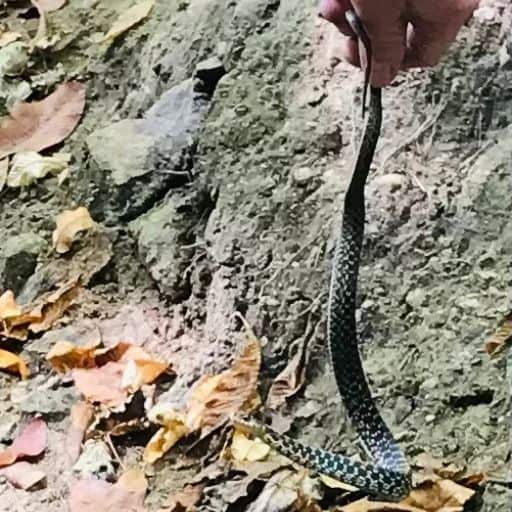
At the base of the falls, you may discover this little guy that we met…
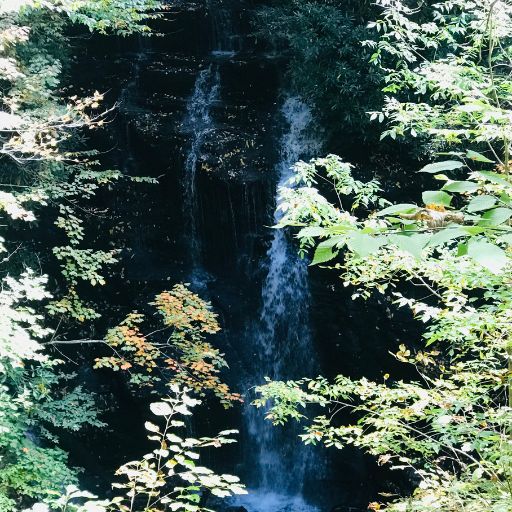
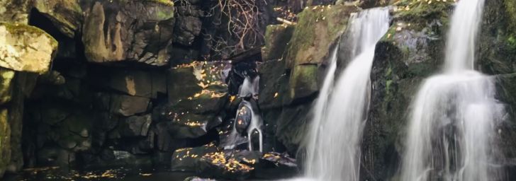
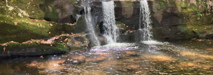
But you will definitely discover this…
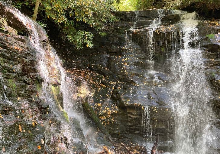
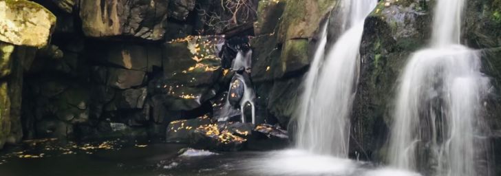
Soco Falls is actually two falls, but you can only see one of them from the observation deck. Both falls are large – both in height and volume. There is a small pool at the base of the falls, then the water continues to flow downstream. You can rock-hop your way right to the base.
Frequently Asked Questions About Smoky Mountains Waterfalls
- Is it worth hiking in the Smoky Mountains? Absolutely! The scenery is magnificent, animals are abundant, (we see at least one black bear every time we’re in the Smokies), and the people are friendly.
- Is it safe to hike in the Smoky Mountains? It is. Most people who have difficulty here have tried hiking above their skill level and/or their physical condition. Stay on the trail, don’t overdo it, and you should be fine.
- Which of these are your Top Five Smoky Mountains waterfalls? #5 – Grotto Falls; #4 – Spruce Flats; #3 – Abrams Falls; #2 – Soco Falls; #1 – Indian Flats Falls
- What animals will I see? Deer, elk, black bears, groundhogs, rabbits, snakes
- Can I swim at the waterfalls? You can wade in the shallow pools at the base of a waterfall, but you should not swim in deeper water, due to the swift current and unseen snags under the water.
The Verdict – 17 Smoky Mountains Waterfalls You’ll Absolutely Love
There you have it – 17 Smoky Mountains Waterfalls You’ll Absolutely Love! Did some of them pique your interest? You can’t go wrong with any of the 17. So the next time your in the Smokies, set aside some time to explore some of these waterfalls. Happy Hiking!
Related Posts
- 15 Unforgettable Things to Do in Cades Cove – Great Smoky Mountains National Park
- Indian Flats Falls – Discover This Amazing Hidden Gem
- Baskins Creek Falls: Hiking in the Great Smoky Mountains
- Spruce Flats Falls Trail: Hiking in the Great Smoky Mountains
- Hen Wallow Falls: Hiking in the Great Smoky Mountains
- 11 Best Easy Hikes in the Great Smoky Mountains National Park: Trail Info, Gear + Map
The Author
Jeff Powell is the Creator/CEO of National Park Ventures. He and his wife Mary Ellen are on a venture to visit every national park in the United States and share what they experience with their readers. Their goal is to help their readers maximize their own national park ventures.
Jeff and Mary Ellen have two sons, two grandkids, and two dogs. They live in the mountains outside Blue Ridge, GA.