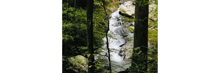
We almost missed Indian Flats Falls, and that would have been a shame because it is truly a gem! It’s a bit of a hike, and it’s not easy to find, but it’s worth it, (especially if you’re willing to do a little bushwacking), because Indian Flats Falls has a secret – it’s multiple levels!
This immediately became one of our favorite Great Smoky Mountains National Park waterfalls. We spent well over an hour there, exploring and taking photos.
Here is everything you need to know to have an amazing experience in this special place.
Published October 30, 2023…Updated January 11, 2025


Overview of Indian Flats Falls
This hike gives you the best of both worlds – the hike itself is beautiful, and so are the falls. Even the drive to the trailhead is something special. It is also relatively uncrowded, especially after you pass Lynn Camp Prong Cascades a little less than 0.7 miles into the hike.
- Distance – 7.8 miles roundtrip hike
- Duration – 3.5-4.5 hours (depending on how long you spend exploring the falls)
- Difficulty – Moderately Challenging. The trail gains 1,178′ of elevation; it’s a constant uphill to the falls. Of course, that means it’s downhill all the way back.
- Dogs – Dogs are not allowed on this trail, but horses are. Watch where you step.
- Restrooms – Yes, at Tremont Institute. You will pass it on your way in and out.
Directions to the Trailhead
It takes just over one hour to drive from Gatlinburg, TN to the trailhead of Middle Prong Trail, the trail that leads to Indian Flats Falls. Enter Great Smoky Mountains National Park at the Sugarlands Visitor Center and continue traveling west on Little River Road for approximately 16 miles. Then take a left onto Tremont Road.
Watch for the sign to the Great Smoky Mountains Institute at Tremont. (It will be on your left.) Continue straight past it for another 3.3 miles. (Unless you would like to stop! There is a small gift shop, vending machines, and restrooms here. The staff here is also very friendly.)
After traveling 3.3 miles on Tremont Road past Tremont Institute, you will dead end into the Middle Prong Trail parking area and trailhead. There is ample parking here.
(Click here for a map from Gatlinburg to Indian Flats Falls.)
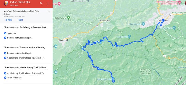
The drive on Tremont Road is beautiful. It’s a gravel road that runs alongside the Middle Prong of the Little River. You’ll see people fishing, picnicking, hiking and biking on the road, or just sitting next to the water and reading. This is our favorite area of the entire park.
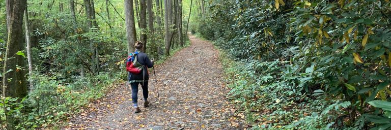
The Middle Prong Trail to the Falls
Starting the Hike to Indian Flats Falls
The trail begins at the far end of the parking lot at the end of Tremont Road. The first thing you will do is cross a bridge. This is a good place to stop for a moment, because the Lynn Camp Prong is very pretty here, especially when you look to your left.

Just after crossing the bridge, you will encounter a fork in the trail. The right fork takes you to Panther Creek Trail, Greenbriar Ridge Trail, and the AT. Don’t go right! You want to take the left fork to the Middle Prong Trail.

The Middle Prong Trail
The Middle Prong Trail runs alongside the Lynn Camp Prong, a beautiful section of creek. At the beginning of the hike, you are just a few steps away from it. There are numerous places where you can stop for photos. (Eventually Lynn Camp Prong gives way to Double Trestle Prong, and finally to Indian Flats Prong.)
The right side of the trail is all about wildflowers. Ferns, rhododendrons, mountain laurel, galax, asters, etc. This area is very green in the summer.
In the fall the changing leaves are gorgeous. We were “serenaded” all along our hike by the sound of falling acorns.
Take time to visit with other hikers along the way. You’ll meet some interesting folks. On our most recent trip, we met a photographer on the trail, dressed in a complete wetsuit, who had been in the water photographing fish! That was a first for us…
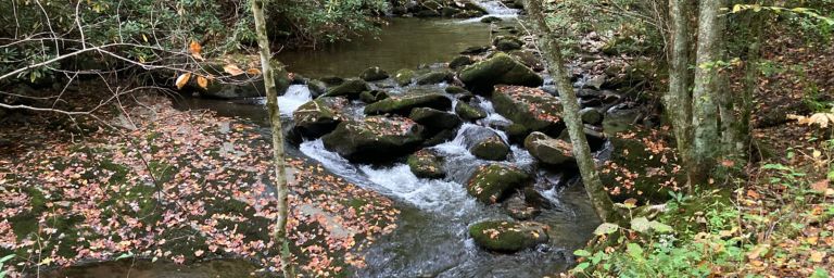
Lynn Camp Prong Cascades
About 10 minutes into the hike you will come to a bench overlooking Lynn Camp Prong Cascades. Stop and take in the view – it’s spectacular. Photo opp! You can walk out to the edge of the cascade from a little farther up the trail, but be very careful if you do!
About 100′ past the first bench you will come to a pair of benches with a view of more cascades. In fact, as you continue to climb, you will see cascade after cascade. The effect is mesmerizing.
You will also continue to move higher above them, and the trail will become rockier and rootier.
Here’s Where it Gets Tricky
After more walking, you will come to a trail sign at the intersection of Panther Trail. Stay on Middle Prong Trail, and continue straight for a bit over 1 mile, where you will come to two sets of switchbacks.
(If you’re new to hiking, a “switchback” is “a trail that cuts sharply from one direction to the other while going up a steep hill or mountainside.” Switchbacks make climbing an incline easier.)
At the beginning of the second switchback, there will be a side trail, but there is no sign, and it is not easy to spot. We missed it the first time!

If you get to the trail sign where Greenbriar Trail and Lynn Camp Prong Trail intersect (like we did), you’ve gone too far. Walk back down the previous switchback. (You will walk down two inclines.). At the second turn, there will be an open space.
Standing in the open space at the bottom of the second incline, you will see a rock face, 5′-7′ high, with a large rhododendron shrub to the right and in front of it. A kind soul has placed a cairn here on top of an old log.

Walk towards the rock face, and behind the rhododendron is a small, narrow trail that leads off to your right. WooHoo! You’ve found it! Follow this small trail. Be careful, because it’s slippery and rooty. After a short five-minute walk, you will emerge at the base of Indian Flats Falls!
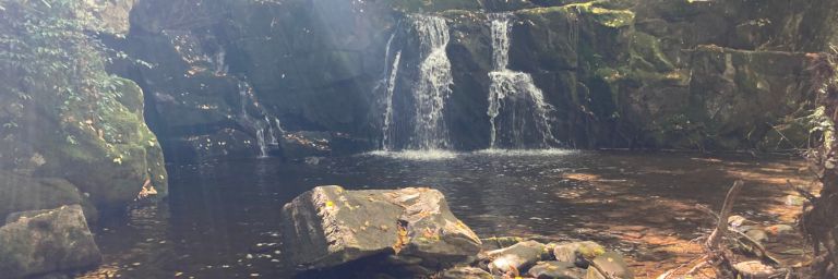
Indian Flats Falls
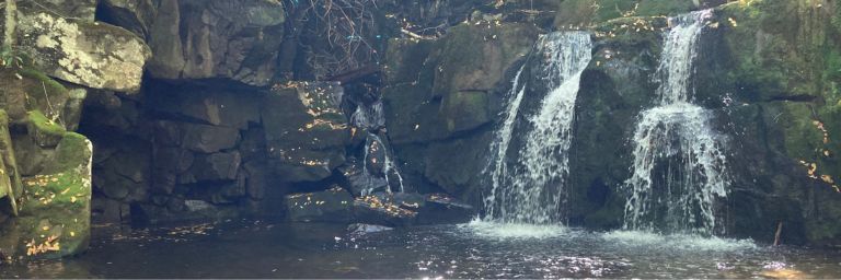
Level One
The trail opens to the base of the upper falls. There are there are three falls here – two larger falls, and a smaller one to the far left. They fall 20′ into a shallow pool. You can walk towards the right side of the pool and rock hop right up to the falls without getting your ankles wet – if you’re wearing boots.
You will notice what appears to be a shallow cave on the left side of the pool. You’ll get a better view of it if you do the rock hopping described above. The water on that side of the pool is deeper.
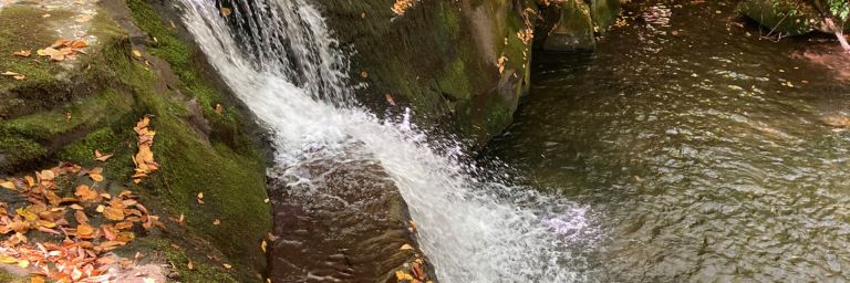
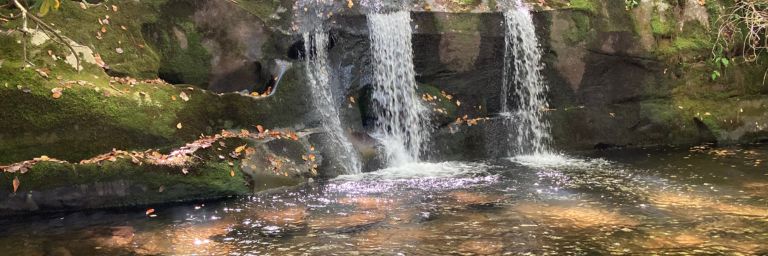
Level Two
When you turn around and look downstream, you’ll see the pool spills out onto the second level of the falls. It drops to a small ledge, then continues down to another small pool. The total drop is 18′ into a small pool. However, you can’t see this level from the top level.
You’re going to have to do some “bushwhacking” (creating your own path) to see anything beyond the upper level of the falls. This is not too hard if you have an adventurous spirit…and aren’t afraid of getting a little muddy.
Enter the woods just below the “hidden” trail that you arrived on. (The “hidden trail” you arrived on will be on your right, and the waterfalls will be on your left.) You can make out a small path heading downhill. Or, if you don’t see it, you can make your own!
Carefully make your way, watching your step – it’s slippery here, and there are a lot of tangled limbs to navigate. You may need to sit on your bottom and slide a bit…
After a few minutes, you will come out at the second level. Take a break and enjoy your hard-earned view. But there’s more!
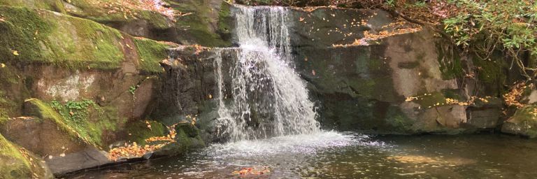
Level Three
Time for a little more bushwhacking, which will take you to the third level of the falls. Just keep making your way downhill through the woods.
This third level is comprised of three separate falls. Again, there is a small pool below them. This is the smallest of the levels, with a drop of only 9′, but they are still well worth the effort to see them.
There is actually a fourth level of falls about 18′ past the third one, but we missed it. I only learned about it later. (Bummer.) It has a 12′ drop. We’ll see it next time!
Frequently Asked Questions
Here are a few things you may be wondering about…
- Is this hike kid-friendly? It depends on the kid. It’s uphill for the first 3.9 miles. If that’s too much, consider just hiking as far as Lynn Camp Cascades. It’s only 1.3 miles roundtrip.
- What else is there to do in this area of the park? The Tremont area is near Cades Cove, which is where Abrams Falls is found. Spruce Flats Falls begins in the Tremont Institute Parking log. Along with Indian Flats Falls, these are three of our favorite waterfalls in the entire park.
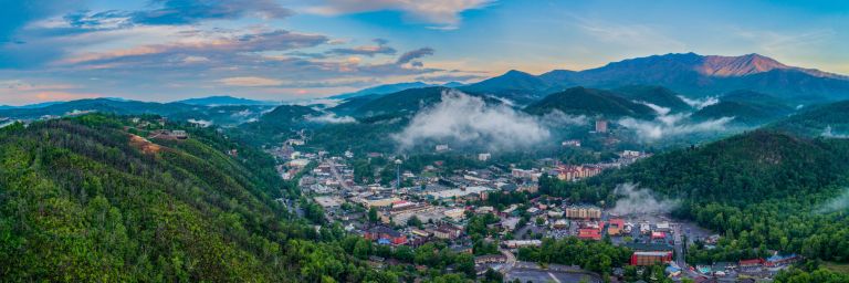
- What’s the nearest town? You’re 22 minutes (8.9 miles) from Townsend; 31 minutes (13 miles) from Wears Valley; 26 miles (62 minutes) from Gatlinburg; and 51 minutes (24 miles) from Pigeon Forge. There are hotels and restaurants in all four of these towns, but the selection is far greater in Gatlinburg and Pigeon Forge.
- What should I bring on the hike? We suggest plenty of water; some food for refueling; good shoes/boots and socks; a jacket, depending on the weather; your camera; hiking poles are helpful; friends!
- Is this hike worth it? Absolutely!
Camping Near Indian Flats Falls
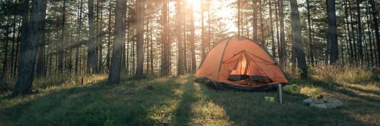
The National Park Service operates 10 frontcountry campgrounds within Great Smoky Mountains National Park. They all have both tent and trailer sites available and include restrooms with cold water and flush toilets. Sorry, no showers.
There is also a fire grate and a picnic table at each camping site, both necessary for enjoying smores after dinner!

The closest campground to Indian Flats Falls is Cades Cove Campground. It is located at the entrance to Cades Cove, 30 minutes (13 miles) from the trailhead to Middle Prong Trail. It is open year-round. Reservations are required.
We recommend you make your reservations early. Great Smoky Mountains National Park is the most visited national park in the United States, and campground openings fill up quickly!
For more info about Cades Cove Campground, visit the National Park Service website at nps.gov.
To make your reservation, go to Recreation.gov.
The Verdict – Indian Flats Falls
We like everything about this hike and waterfall. The hike follows the beautiful, noisy Lynn Camp Prong for most of the way. The waterfall has four levels, is wonderfully serene, and is fun to explore. Even the drive to the trailhead on Tremont Road is lovely!
So on your next trip to Great Smoky Mountain National Park, may I suggest you put this hike at the top of your list? Happy Hiking!
Related Posts
- 17 Smoky Mountains Waterfalls You’ll Absolutely Love
- 15 Unforgettable Things to Do in Cades Cove – Great Smoky Mountains National Park
- Baskins Creek Falls: Hiking in the Great Smoky Mountains
- Spruce Flats Falls Trail: Hiking in the Great Smoky Mountains
- Hen Wallow Falls: Hiking in the Great Smoky Mountains
- 11 Best Easy Hikes in the Great Smoky Mountains National Park: Trail Info, Gear + Map

The Author
Jeff Powell is the Creator/CEO of National Park Ventures. He and his wife Mary Ellen are on a venture to visit every national park in the United States and share what they experience with their readers. Their goal is to help their readers maximize their own national park ventures.
Jeff and Mary Ellen have two sons, two grandkids, and two dogs. They live in the mountains outside Blue Ridge, GA.